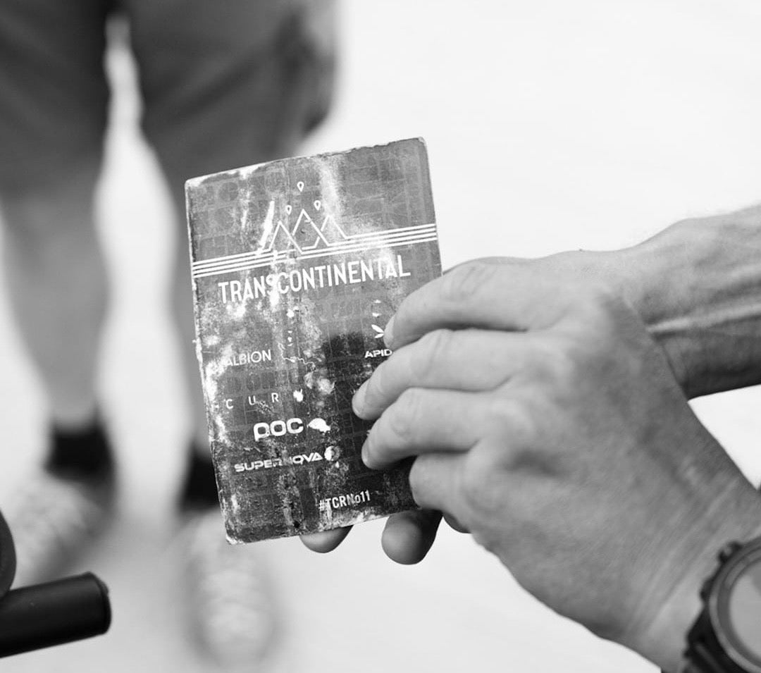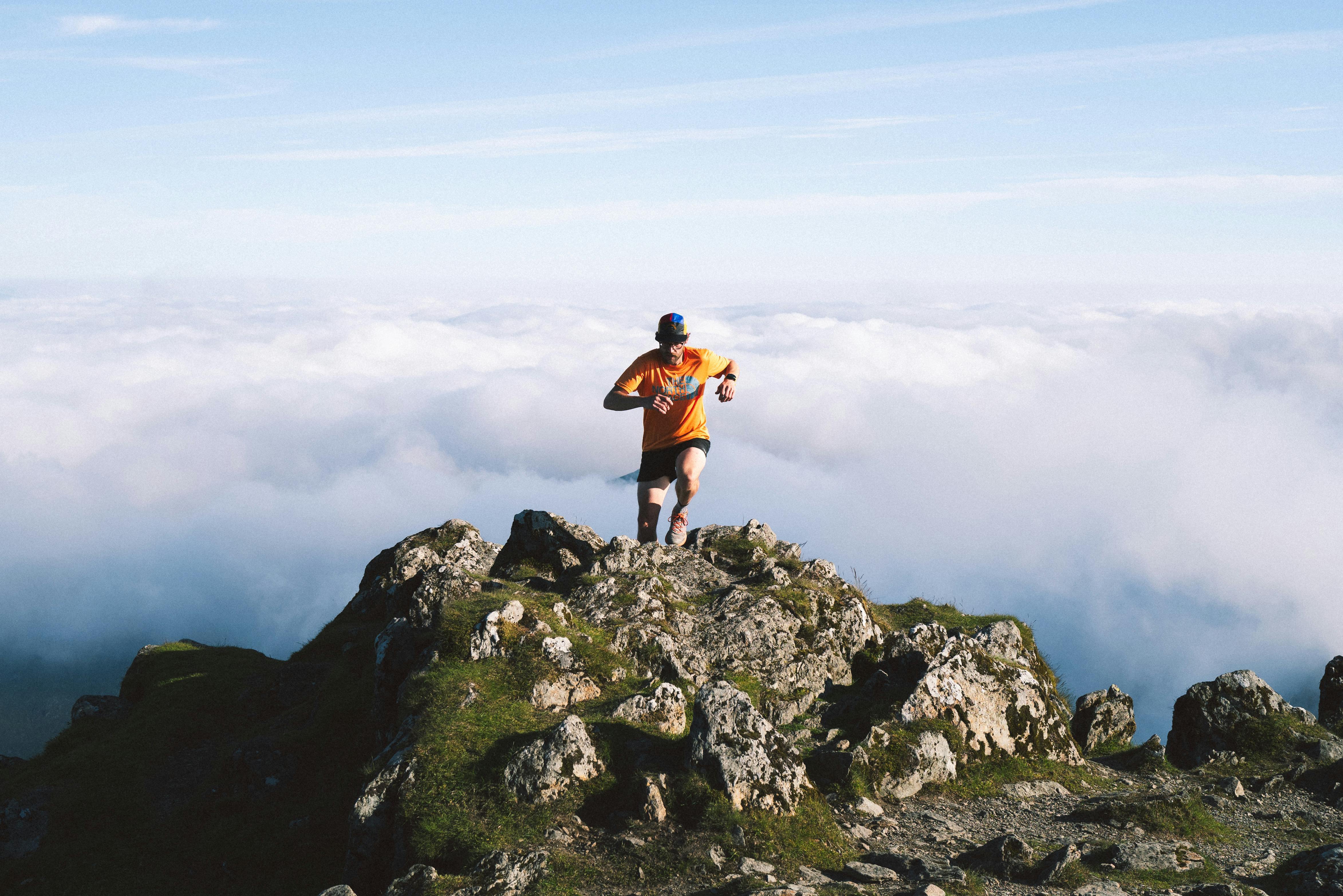
For endurance athletes, the best holidays aren’t just about rest, they’re about epic trails that push your limits and reward you with unforgettable views. It’s a chance to connect with the land, recharge, and experience nature's raw beauty.
This guide curates 20+ unforgettable routes across the globe, balancing bucket-list icons with under-the-radar gems. Whether you’re training for an ultra, planning a multi-day trek, or just exploring on foot, you’ll find trails here to challenge and inspire you.
And since endurance is our game, we’ve included key stats like distance, elevation and difficulty to help you plan—and fuel—your adventure.
👉 Follow @oleus.official for inspiring athlete stories, gear tips, and even more trail inspo from around the world.
Let’s get started!
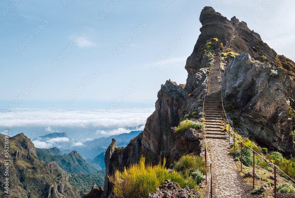
Canary Islands, Spain 🇪🇸
Tenerife: Anaga Rural Park & Teide National Park
📏 Distance: 10–20 km
⛰️ Elevation gain: Up to 1,200 m
🎯 Difficulty: Moderate to hard (rocky terrain, exposure)
👥 Crowds: 4/5 (Sunrise at Teide draws crowds; go midweek or explore Anaga’s quieter loops)
This is two worlds, on one island. Start in Anaga’s mist-soaked laurel forests—a UNESCO Biosphere Reserve where trails weave through Jurassic-looking greenery. Then shift to the volcanic moonscapes of Mount Teide, Spain’s highest peak at 3,718 m.
Pro tip: For altitude training, the Montaña Blanca to Teide route is brutal but unforgettable.
La Palma: Ruta de los Volcanes
📏 Distance: 17 km (one way)
⛰️ Elevation gain: 700 m
🎯 Difficulty: Moderate
👥 Crowd rating: 2/5 (Quiet, especially off-season)
Run on the moon. This black-sand ridge trail traces the island’s volcanic spine, with ocean clouds pooling below your feet. Exposed and dramatic, Ruta de los Volcanes is ideal for a supported long run or sunrise effort.
Gran Canaria: Roque Nublo & Tamadaba Natural Park
📏 Distance: 10–25 km
⛰️ Elevation gain: 1,000 m+
🎯 Difficulty: Moderate to hard
👥 Crowd rating: 3/5 (Roque Nublo is well-known, but many routes in the area stay quiet)
This one is a volcanic playground with big views. Dodge crowds at the iconic Roque Nublo by linking lesser-known trails like Circular de Tejeda. You can also choose for Tamadaba Natural Park, where you can expect pine-scented singletrack, rugged climbs, and dramatic ridge views.
La Gomera: Garajonay National Park
📏 Distance: 12–20 km
⛰️ Elevation gain: 600–1,200 m
🎯 Difficulty: Moderate
👥 Crowd rating: 1/5 (You’ll see more lizards than people)
This UNESCO-listed laurel forest feels prehistoric. Think spongy trails under emerald canopies, sudden ridgeline panoramas, and near-silence. Great for base miles or long steady runs in deep nature.
France 🇫🇷
Chamonix: Mont Blanc Trails
📏 Distance: 10–30 km
⛰️ Elevation gain: Up to 2,000 m
🎯 Difficulty: Moderate to hard
👥 Crowds: 4/5 (July hordes vanish at sunrise; September is golden)
These trails are the gold standard of alpine running—glacier-fed valleys, switchbacks, and the ever-present gaze of Mont Blanc. For high-altitude prep, link the Grand Balcon Nord (20km of wildflower ridges) with the Buvette de la Flégère climb. Pre-dawn starts reward you with pink-lit glaciers and empty trails.
Provence: Gorges du Verdon & Montagne Sainte-Victoire
📏 Distance: 10–18 km
⛰️ Elevation gain: 300–800 m
🎯 Difficulty: Easy to moderate
👥 Crowds: 3/5 (Popular spots see visitors, but Sainte-Victoire’s north side stays serene)
Lavender fields, white cliffs, and Mediterranean light—these trails are more about flow than grind. Verdon’s canyon paths deliver big views with mild technical sections. The Sentier de l’Imbut threads through Verdon’s narrowest canyon, while Sainte-Victoire’s backside offers quiet olive grove loops.
Cevennes – Stevenson Trail (GR70)
📏 Distance: 272 km (multi-day)
⛰️ Elevation gain: 6,000 m+ total
🎯 Difficulty: Moderate
👥 Crowds: 2/5 (May and September feel like you own the trail)
Follow Robert Louis Stevenson’s 1878 journey through chestnut forests, granite hills, and shepherd hamlets. The full 272km route is a fastpacker’s dream, but the Le Bleymard to Le Pont de Montvert section delivers the best solitude-to-scenery ratio. Sleep in gîtes, refuel on aligot (cheesy potato mash), and embrace the slow burn.
Italy 🇮🇹
Lake Garda: Sentiero del Ponale & Monte Baldo
📏 Distance: 10–20 km
⛰️ Elevation gain: Up to 1,000 m
🎯 Difficulty: Moderate
👥 Crowds: 3/5 – Ponale is popular, but Monte Baldo offers space to move
The Ponale Path is Italy’s most scenic—a carved cliffside route above electric-blue water, ending in Riva del Garda’s espresso bars. For a real challenge, Monte Baldo’s climb rewards you with 360° lake-and-Alp views (and a gelato-fueled descent). Pro move: Take the cable car up, then run the ridge to Rifugio Altissimo.
Dolomites: Tre Cime di Lavaredo & Alta Via Routes
📏 Distance: 10–30 km
⛰️ Elevation gain: Up to 1,800 m
🎯 Difficulty: Moderate to hard
👥 Crowds: 4/5 (Tre Cime is iconic and busy; go early or hit the higher Alta Vias)
The Dolomites are rugged, vertical, and unforgettable. Tre Cime is a must-see loop, but the real adventure lies on the Alta Via routes—multi-day traverses across jagged ridgelines, alpine huts, and high meadows.
Sibillini Mountains: Grande Anello dei Sibillini
📏 Distance: 120 km (multi-day loop)
⛰️ Elevation gain: 5,000 m+
🎯 Difficulty: Moderate to hard
👥 Crowds: 2/5 (Wild and quiet, even in peak season)
Mystical and less-traveled, this loop runs through flower-covered valleys, ghost villages, and the legendary Sibyl’s Cave. Less polished than the Dolomites, but richer in solitude and folklore (watch for wolves at dusk).
Sardinia: Selvaggio Blu
📏 Distance: 40 km (multi-day)
⛰️ Elevation gain: 3,000 m+
🎯 Difficulty: Very hard
👥 Crowds: 1/5 (Remote, technical, and mostly untouched)
Not for the faint of heart. Selvaggio Blu is often called Europe’s toughest trek—think cliffside scrambles, rope sections, and zero margin for error. But the views? Unreal. Turquoise coves, wild goats, and pure Mediterranean wilderness.
Portugal 🇵🇹
Lisbon Coast: Sintra Forest & Rota Vicentina
📏 Distance: 10–25 km
⛰️ Elevation gain: 500–1,000 m
🎯 Difficulty: Moderate
👥 Crowds: 3/5 (Sintra gets busy near the palaces; Rota Vicentina is quieter midweek)
Atlantic cliffs, enchanted forests, and cobbled village climbs. Sintra feels like a real-life fairytale, with trails that wind past castles, hidden chapels, and mossy stone walls. Further south, the Rota Vicentina stretches along raw, rugged coastline—perfect for long, rolling efforts on wild singletrack.
Madeira: Levada Trails, Pico Ruivo & Ponta de São Lourenço
Top picks:
-
Levada do Caldeirão Verde: 13 km / 600 m gain / Moderate
-
Pico Ruivo (via Achada do Teixeira): 11 km / 900 m gain / Hard
-
Ponta de São Lourenço: 8 km / 400 m gain / Moderate
👥 Crowds: 3/5 (Popular routes, but early starts = near solitude)
Madeira is a trail runner’s dream. Levada paths hug mossy cliffs through jungle-like greenery. Pico Ruivo takes you above the clouds to the island’s highest peak, with amazing sunrise views. São Lourenço offers a drier, windswept contrast, like running along the spine of the Atlantic.
Slovenia 🇸🇮
Julian Alps, Triglav National Park
📏 Distance: 15–30 km
⛰️ Elevation gain: Up to 1,800 m
🎯 Difficulty: Moderate to hard
👥 Crowds: 2/5 (Way quieter than the Dolomites, especially outside high season)
Slovenia’s best-kept secret. The Julian Alps deliver everything you love about the Dolomites—jagged peaks, glacial lakes, wildflower meadows—but with fewer people. Trails around Lake Bohinj and the ascent to Mount Triglav (2,864 m) are perfect for pushing vertical without the tourist traffic.
Switzerland 🇨🇭
Zermatt: Matterhorn Trails
📏 Distance: 12–25 km
⛰️ Elevation gain: Up to 1,200 m
🎯 Difficulty: Moderate to hard
👥 Crowds: 4/5 (Iconic status brings traffic, but early starts are golden)
Every step here is a postcard come to life with wildflower meadows, glacial valleys, and the iconic Matterhorn looming overhead. The 5-Seenweg (5 Lakes Trail) serves up mirror-like reflections of the peak, while the Hörnli Hut climb delivers thin-air thrills for those chasing vert.
Pro tip: Start at dawn to beat the crowds and catch the Matterhorn’s golden glow.
Lauterbrunnen: Jungfrau Region
📏 Distance: 10–20 km
⛰️ Elevation gain: 600–1,000 m
🎯 Difficulty: Moderate
👥 Crowds: 3/5 (Popular but never overwhelming, especially on ridge routes)
Think waterfalls, cowbells, and panoramic ridge paths. This area blends classic Swiss charm with runnable alpine trails. The route from Mürren to Schilthorn is a fan favorite. For a hidden gem, try the Sefinenfurgge Pass, which is steep, quiet, and wildflower-carpeted.
Engadin: St. Moritz & Bernina Range
📏 Distance: 15–30 km
⛰️ Elevation gain: Up to 1,500 m
🎯 Difficulty: Moderate to hard
👥 Crowds: 2/5 (High-alpine quietude, especially beyond the resort zones)
This is Switzerland’s trail-running nirvana—smooth singletrack along turquoise lakes, passes like Diavolezza, and the Bernina Glacier’s icy drama. The Engadin Trail network lets you craft 20-50km days with minimal crowds. Local secret: Fex Valley for silent larch forests and old-world hamlets.
South Africa 🇿🇦
Table Mountain
📏 Distance: 8–12 km (various routes)
⛰️ Elevation gain: 600–1,000 m
🎯 Difficulty: Moderate
👥 Crowds: 4/5 (Popular with locals and tourists, especially in the mornings)
Cape Town’s crown jewel. Table Mountain offers steep climbs straight from sea level to sky-high views. Trails like Platteklip Gorge or Skeleton Gorge will get your legs and lungs working fast.
Lion’s Head
📏 Distance: ~5 km round trip
⛰️ Elevation gain: ~400 m
🎯 Difficulty: Moderate
👥 Crowds: 5/5 ( A favorite for sunrise and sunset)
Short but spicy, Lion’s Head delivers 360° views after a rocky spiral ascent. Expect a mix of steep switchbacks, scrambling, and some light climbing near the top.
USA 🇺🇸
Flagstaff, Arizona
📏 Distance: 16 km
⛰️ Elevation gain: 1,000 m+
🎯 Difficulty: Hard
👥 Crowds: 2/5 (Quiet overall, but summit sees more hikers on weekends)
At 3,850 m, Humphreys Peak is the highest point in Arizona—and a brutal but beautiful high-altitude climb. The trail starts in thick pine forest and breaks above the treeline into volcanic rock and sweeping views. Ideal for heat training and altitude work.
Na Pali Coast, Hawaii
📏 Distance: 35 km return (Kalalau Trail)
⛰️ Elevation gain: 1,200 m+
🎯 Difficulty: Hard
👥 Crowds: 3/5 (Remote, but access restrictions help regulate traffic)
One of the world’s most iconic coastal trails. The Kalalau Trail hugs sheer cliffs above the Pacific, crossing rivers and jungles on its way to a secluded beach at Kalalau Valley. It’s humid, exposed, and unforgettable.
New Zealand 🇳🇿
Tongariro Alpine Crossing
📏 Distance: 19.4 km
⛰️ Elevation gain: 750 m
🎯 Difficulty: Moderate to hard
👥 Crowds: 4/5 (Popular and regulated; early starts are key)
A surreal, Mars-like landscape with steaming vents, red craters, and emerald lakes. The Tongariro Crossing is New Zealand’s most iconic day hike for good reason—it’s exposed, dramatic, and runnable in sections.
Routeburn Track
📏 Distance: 32 km (multi-day)
⛰️ Elevation gain: 1,200 m+
🎯 Difficulty: Moderate
👥 Crowds: 3/5 (Managed via hut permits; plenty of trail time to yourself)
This is New Zealand backcountry at its best: alpine passes, swing bridges, waterfalls, and glacial valleys. Typically done in 2–3 days, it’s ideal for fastpacking or long slow efforts in epic terrain.
Australia 🇦🇺
Blue Mountains, New South Wales
📏 Distance: 6 km (Grand Canyon Track)
⛰️ Elevation gain: 300 m
🎯 Difficulty: Moderate
👥 Crowds: 3/5 (Close to Sydney, gets busy on weekends and holidays)
The Grand Canyon Track is a lush, runnable loop through mossy gorges, sandstone overhangs, and fern-lined trails. It’s short but scenic, perfect for an easier shakeout or a fast-paced tempo in cool forest air.
Overland Track, Tasmania
📏 Distance: 65 km (multi-day)
⛰️ Elevation gain: 2,000 m+
🎯 Difficulty: Moderate to hard
👥 Crowds: 2/5 (Regulated entry keeps things peaceful and remote)
This world-class trek runs through alpine plains, glacial valleys, and ancient rainforests in Cradle Mountain–Lake St Clair National Park. Expect rugged terrain, fast-changing weather, and long stretches without seeing another soul.
Japan 🇯🇵
Kumano Kodo
📏 Distance: 38 km (multi-day)
⛰️ Elevation gain: Varies across routes
🎯 Difficulty: Moderate
👥 Crowds: 2/5 (Peaceful and spiritual, even during peak season)
This UNESCO-listed pilgrimage route winds through cedar forests, stone staircases, and ancient shrines. It’s ideal for multi-day runners looking to combine culture with endurance. Expect a deep sense of calm and some seriously steep sections.
Mount Fuji (Yoshida Trail)
📏 Distance: 14 km
⛰️ Elevation gain: 1,500 m
🎯 Difficulty: Hard
👥 Crowds: 5/5 (Draws big crowds, especially in July and August)
Japan’s highest peak is a short, steep grind straight into the sky. The Yoshida Trail is the most popular ascent route, with volcanic switchbacks, mountain huts, and thin air all the way to 3,776 m.
Nakasendo Trail (Magome to Tsumago)
📏 Distance: 8 km
⛰️ Elevation gain: 300 m
🎯 Difficulty: Easy to moderate
👥 Crowds: 2/5 (Quiet and charming, with just a handful of hikers on weekdays)
A gentle point-to-point through preserved Edo-period villages, cobblestone paths, and mountain forest. Perfect for an active rest day or relaxed exploration on foot.
China 🇨🇳
Tiger Leaping Gorge
📏 Distance: 22 km
⛰️ Elevation gain: 1,300 m
🎯 Difficulty: Hard
👥 Crowds: 2/5 (Remote and peaceful, especially past the first few kilometers)
One of Asia’s most dramatic trails, Tiger Leaping Gorge cuts between 5,000-meter peaks and the roaring Yangtze River. Narrow paths cling to the cliffside with epic drop-offs and heart-thumping climbs. Raw, remote, and unforgettable.
Huangshan (Yellow Mountain)
📏 Distance: 10–20 km (various loop options)
⛰️ Elevation gain: Up to 1,800 m
🎯 Difficulty: Moderate to hard
👥 Crowds: 4/5 (Tourist hotspots can be busy, but early mornings and back loops are quiet)
Welcome to stairway heaven. Huangshan is known for its granite peaks, misty pine-covered ridges, and ancient stone steps that seem to stretch into the clouds. It’s cinematic, steep, and spiritual.
Sri Lanka 🇱🇰
Knuckles Mountain Range
📏 Distance: 25–30 km
⛰️ Elevation gain: 1,200 m
🎯 Difficulty: Moderate to hard
👥 Crowds: 2/5 (Remote and quiet, even during peak season)
Wild, technical, and off the radar. The Knuckles Range is a network of rugged jungle trails, steep ridgelines, and misty peaks. Expect stream crossings, slippery rocks, and sweeping views—perfect for long efforts in raw terrain.
Ella Rock
📏 Distance: 10 km
⛰️ Elevation gain: 600 m
🎯 Difficulty: Moderate
👥 Crowds: 3/5 (Popular at sunrise, but thins out fast)
A crowd-pleaser with real payoff. The Ella Rock route starts along train tracks and tea plantations before climbing to a rocky viewpoint over the central highlands. It’s a relatively short run, and the views are amazing.
World’s End (Horton Plains)
📏 Distance: 9 km
⛰️ Elevation gain: 300 m
🎯 Difficulty: Easy to moderate
👥 Crowds: ⅗ (Busier near the lookout, but the full loop is mellow and scenic)
World’s End is a high-altitude plateau trail with panoramic cliffs and cool forest air. The main lookout offers a 900m vertical drop—yes, straight down—and on clear days, you can see all the way to the coast.
Colombia 🇨🇴
Cocora Valley
📏 Distance: 12 km
⛰️ Elevation gain: 450 m
🎯 Difficulty: Moderate
👥 Crowds: 3/5 (Popular with tourists, especially midday)
Home to the world’s tallest wax palms, Cocora is a trail runner’s visual dream. The route loops through cloud forest, suspension bridges, and open valleys lined with surreal vertical trees.
Tayrona National Park
📏 Distance: 16 km
⛰️ Elevation gain: Minimal
🎯 Difficulty: Moderate
👥 Crowds: 2/5 (Quiet once you leave the beaches)
Run from jungle to beach in one go. Tayrona’s trails weave through tropical forest, hidden coves, and coastal cliffs. The heat and humidity are real—but so are the post-run swims.
Chicamocha Canyon
📏 Distance: 10–20 km
⛰️ Elevation gain: 800–1,200 m
🎯 Difficulty: Hard
👥 Crowds: 1/5 (Rugged, remote, and almost empty)
This deep-cut canyon delivers quad-busting climbs and blazing sun. Trails zigzag through dry brush and rocky terrain with dramatic drops and huge vertical. One for the grinders.
Norway 🇳🇴
Romsdalseggen Ridge
📏 Distance: 10–12 km
⛰️ Elevation gain: 1,000 m
🎯 Difficulty: Hard
👥 Crowds: 2/5 (Less crowded than other famous Norwegian hikes)
A wilder, more rugged alternative to Norway’s headline trails. Romsdalseggen offers narrow ridge lines, fjord views, and just enough exposure to keep things exciting. It’s steep, raw, and incredibly rewarding.
Trolltunga
📏 Distance: 22 km
⛰️ Elevation gain: 1,100 m
🎯 Difficulty: Hard
👥 Crowds: 4/5 (Iconic photo spot = heavy foot traffic in summer)
Trolltunga (“The Troll’s Tongue”) is as dramatic as it gets—an epic out-and-back with glacier views, stone plateaus, and that famous ledge hanging above the lake. Long, exposed, and beautiful.
Besseggen Ridge
📏 Distance: 13 km
⛰️ Elevation gain: 900 m
🎯 Difficulty: Moderate to hard
👥 Crowds: 3/5 (Well-known, but traffic is spaced out across the trail)
One of Norway’s most beloved ridge hikes. Besseggen runs between two lakes—one turquoise, one deep blue—with knife-edge sections and non-stop views. Great for a long push or technical tempo.
Morocco 🇲🇦
Jebel Toubkal
📏 Distance: 20 km
⛰️ Elevation gain: 1,400 m
🎯 Difficulty: Hard
👥 Crowds: 3/5 (Popular with trekkers, but the altitude and effort keep it calm)
At 4,167 m, Jebel Toubkal is North Africa’s highest peak—and a serious undertaking. The classic route from Imlil involves a long, steady ascent through rocky switchbacks, windswept ridges, and snowy sections at the top.
Imlil Valley Trails
📏 Distance: 8–15 km
⛰️ Elevation gain: 600–900 m
🎯 Difficulty: Moderate
👥 Crowds: 2/5 (Quiet and local, especially outside of Toubkal’s base camp zone)
For a more relaxed loop, the Imlil Valley offers runnable ridgelines, terraced fields, and a glimpse into Berber mountain life. It’s ideal for recovery runs or shorter days when altitude is still in play.
Kenya 🇰🇪
Mount Kenya (Sirimon Route)
📏 Distance: 28 km (multi-day)
⛰️ Elevation gain: 1,600 m
🎯 Difficulty: Hard
👥 Crowds: 2/5 – Less busy than Kilimanjaro, especially on the Sirimon side
Africa’s second-highest peak offers a rawer, less-commercial alternative to Kilimanjaro. The Sirimon Route climbs steadily through bamboo forests, high-altitude moorlands, and alpine ridges en route to Point Lenana (4,985 m). Rugged, remote, and high-performance.
Tanzania 🇹🇿
Mount Kilimanjaro (Marangu Route)
📏 Distance: 64 km (multi-day)
⛰️ Elevation gain: 4,000 m+
🎯 Difficulty: Very hard
👥 Crowds: 4/5 (Popular route, but effort and altitude keep it thinned out)
The Marangu Route is Kilimanjaro’s classic trail—hut-based, well-marked, and relentless. Over five days, you’ll move through rainforest, moorland, and alpine desert to reach Uhuru Peak at 5,895 m. It’s less technical than other routes, but still a massive endurance feat.
Usambara Mountains (Lushoto Trails)
📏 Distance: 10–20 km
🎯 Difficulty: Moderate
👥 Crowds: 1/5 – Remote and under-the-radar
Quiet trails through rolling ridgelines, cloud forest, and remote villages. The Lushoto area offers scenic, runnable terrain without the altitude stress—perfect for shakeouts or low-key adventure days.
Guatemala 🇬🇹
Acatenango Volcano
📏 Distance: 14 km
⛰️ Elevation gain: 1,500 m
🎯 Difficulty: Hard
👥 Crowds: 3/5 (Popular with trekkers, but spaced out by pace and altitude)
One of Central America’s most intense and rewarding climbs. The Acatenango trail takes you through farmland, cloud forest, and ash-covered switchbacks to a summit above the clouds, where you can watch neighboring Fuego Volcano erupt in real time.
Lake Atitlán (San Juan to San Marcos)
📏 Distance: 15 km
⛰️ Elevation gain: 600 m
🎯 Difficulty: Moderate
👥 Crowds: 2/5 (Quiet on trail, with only the occasional local runner or farmer)
Run along coffee plantations, forested paths, and ridge trails with panoramic lake views below. This point-to-point trail between San Juan and San Marcos is ideal for steady-state runs with a cultural backdrop and epic scenery.
Mexico 🇲🇽
Copper Canyon Trails
📏 Distance: 10–40 km
⛰️ Elevation gain: 800–2,000 m
🎯 Difficulty: Moderate to hard
👥 Crowds: 1/5 (Remote, rugged, and almost empty)
Legendary terrain and home of the Tarahumara runners, Copper Canyon is raw and expansive. Trails here dive deep into desert gorges, with steep climbs, switchbacks, and dramatic views around every bend. Best suited for experienced trail runners or fastpackers.
Nevado de Toluca (Crater Loop)
📏 Distance: 13 km
⛰️ Elevation gain: 800 m
🎯 Difficulty: Hard
👥 Crowds: 2/5 (Quiet midweek; busier on weekends near the crater)
This high-altitude volcano near Mexico City features a runnable loop around twin crater lakes at over 4,000 m. Thin air, volcanic dust, and sweeping summit views make it a must-do for training or adventure.
Chile 🇨🇱
Torres del Paine (W Trek)
📏 Distance: 76 km (multi-day)
🎯 Difficulty: Moderate to hard
👥 Crowds: 3/5 (Popular route, but permits and remoteness keep it manageable)
Glaciers, turquoise lakes, and jagged granite spires—Patagonia’s W Trek delivers legendary scenery with every step. Typically done over 4–5 days, this route is ideal for fastpackers or strong hikers wanting to go long in wild conditions.
Valle de la Luna, Atacama Desert
📏 Distance: 10 km
⛰️Elevation gain: 817m
🎯 Difficulty: Easy
👥 Crowds: 2/5 (Wide open and spread out, especially at sunrise or sunset)
Run across a Martian landscape of sand dunes, salt flats, and sculpted canyons. Valle de la Luna (Valley of the Moon) is short, dry, and scenic—perfect for an acclimation run or evening shakeout.
Argentina 🇦🇷
Laguna de los Tres (El Chaltén, Patagonia)
📏 Distance: 20 km
⛰️ Elevation gain: 1,200 m
🎯 Difficulty: Moderate to hard
👥 Crowds: 3/5 (Popular in season, but early starts offer quiet stretches)
A classic Patagonian climb with nonstop views of Mount Fitz Roy. The route starts mellow, then ramps up with switchbacks to the glacier-fed Laguna de los Tres. Wind, exposure, and raw beauty—this one’s a rite of passage.
Quebrada de las Conchas (Salta)
📏 Distance: 15 km
⛰️ Elevation gain: 400 m
🎯 Difficulty: Easy to moderate
👥 Crowds: 2/5 (Quiet and scenic, especially midweek)
Think desert canyon meets natural sculpture park. This red-rock trail in northwest Argentina runs through vibrant sandstone formations like the Garganta del Diablo and the Amphitheater. It’s runnable, surreal, and low-stress.
Indonesia 🇮🇩
Mount Rinjani (Lombok)
📏 Distance: 25 km (multi-day)
⛰️ Elevation gain: 2,500 m
🎯 Difficulty: Very hard
👥 Crowds: 2/5 (Regulated access and remoteness keep traffic low)
An absolute monster of a volcano. The trek up Rinjani takes you through tropical jungle, barren crater ridges, and finally to the summit at 3,726 m. Long days, steep climbs, and hot conditions make this a true testpiece.
Campuhan Ridge Walk (Bali)
📏 Distance: 6 km
🎯 Difficulty: Easy
👥 Crowds: 3/5 (Busy near town, but clears out early or late in the day)
A peaceful, paved trail just outside Ubud, surrounded by lush jungle and rice fields. It’s ideal for a recovery run, sunrise jog, or mid-trip shakeout.
Nepal 🇳🇵
Poon Hill Trek
📏 Distance: 32 km (multi-day)
🎯 Difficulty: Moderate
👥 Crowds: 3/5 (Popular with trekkers, but early starts and shoulder season offer space)
A perfect intro to Himalayan trail life. Poon Hill delivers sweeping sunrise views over Annapurna and Dhaulagiri, with a moderate climb through rhododendron forests and stone-stepped villages.
Annapurna Base Camp (ABC) Trek
📏 Distance: 70 km (multi-day)
🎯 Difficulty: Hard
👥 Crowds: 3/5 (Well-trodden but manageable outside peak months)
A Himalayan classic with serious payoff. The ABC trek takes you deep into the Annapurna Sanctuary, surrounded by 7,000–8,000m peaks. Expect a mix of altitude, technical stairs, and unreal backdrops.
Vietnam 🇻🇳
Fansipan via Tram Ton Pass (Sapa Highlands)
📏 Distance: 12 km
⛰️ Elevation gain: 1,400 m
🎯 Difficulty: Hard
👥 Crowds: 3/5 (Popular on weekends, quieter with early starts or weekday efforts)
Fansipan is Vietnam’s highest peak—and it earns the nickname “the Roof of Indochina.” The Tram Ton route is steep, slippery, and packed with jungle, roots, and big stair sections. It’s short, but intense.
Which Trail Will You Conquer?
Tag @oleus.official in your trail photos and we’ll feature the most epic adventures! You can also join the OLEUS endurance tribe on Instagram to get exclusive trail hacks, athlete stories, and training tips.
Want to fuel your next adventure with OLEUS Endurance Shots. Explore our full range and gear up at OLEUS.com.